Wyloo North and Northeast Creek Crossing Study & Drainage Design
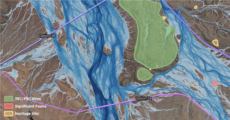
Our team completed a comprehensive surface water assessment to design floodways and culverts for five major creek crossings and 182 minor crossings for a 56 km haul road. The assessment was undertaken for the proposed Wyloo North transport alignment (132 km) located approximately 135 km west of Tom Price. The surface water assessment used a variety of hydrologic methods to derive design flows including regional methods and RORB, which were validated against relevant gauged catchments. Climate change effects in the form of present-day warming were incorporated into the modelling in accordance with the latest version of Australian Rainfall and Runoff. The floodway, culvert, and geometric design outcomes were incorporated into a multi criteria analysis and cost estimate to form part of a complex set of considerations for Fortescue to progress the project to the next design stage.
“Agilitus’ hydrology capability is built on combining strong technical modelling with a practical understanding of how projects are designed and delivered. We focus on developing fit-for-purpose solutions, clearly communicating complex results and giving clients the confidence to make informed decisions.”
Hydrology & Water Capability Statement

IGNITE available now